When History Goes Underground
I’m staring up at the brilliant blue sunshiny sky through the segmented semi-circles of a manhole cover ten meters above me. The racketing sound of cars driving over the manhole cover reverberates down the chimney-like space to where I stand and I can hear the water rushing down the water-tunnels we’re walking in, fully kitted with Wellingtons and head lamps, looking for all like slightly wet Wombles.
It’s Saturday morning and the barefoot mountain guide (for once, not barefoot) and I have joined a group of intrepid (debatable) explorers who are taking a 2 hour walk down through Cape Towns underground water tunnels all the way down to the Castle where we clamber out mole-like from the dark through a manhole and blink at the sunlight. I realise this may seem a strange leisure activity, but bear with me – there is some method involved.
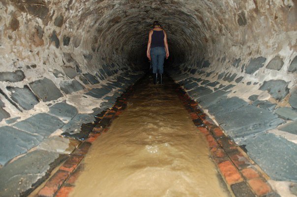
The barefoot mountain guide came across a group on Facebook called “Reclaim Camissa” which a friend of his had joined (the friend, a zany blonde Norwegian had thought the Camissa in the title referred to a cool bar that had closed down on Kloof street and been replaced by an estate agent, but nonetheless) and it turns out that this is a group lead by a passionate environmental planner who discovered in her research that Cape Town originated around various rivers that ran down the mountains and through what is now the city bowl. “Camissa” being a Khoi-San word meaning “Sweet Water” and their original name for the Cape Town area for obvious reasons.
One major stream ran down Platteklip Gorge and split into two. The major stream continued to run down what is now Heerengracht street, while the minor stream was diverted by none other than van Riebeeck himself who used a system of furrows to irrigate the Gardens he had established in order to be a victualling station for passing ships.
As an aside, I was fascinated to learn that the recommendation to the DEIC to create this victualling station was only made because he and the rest of the Haarlem crew were shipwrecked in Table Bay in 1648. So based on the fact that there was good water and it seemed a good spot to grow food and things, the DEIC let them set up a station here in competition to the one on St Helena. But I digress.
In 1660 van Riebeeck, having already had to warn people nearby not to let their sheep and geese and rubbish piles pollute the water channels through the city, widened and deepened the main furrow into a fully fledged canal or “gracht”, and built a dam for filling water casks near the jetty. You can actually see some of this canal in the Golden Acre shopping centre today – they unearthed the remains of it in the 1970’s when building the complex and it is glassed in next to one of the escalators and thousands of people pass by it every day as they go about their business in the city.
Anyway, back to the water.
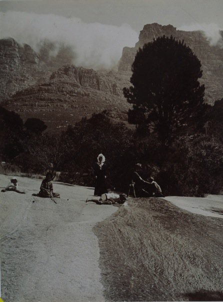 Platteklip stream, Table Mountain c1900
The short version, without retracing and restating all of South African history in the process – is that the stream / river that was pretty much the reason for Cape Towns existence and was for almost 200 years the centre of the city’s existence, got lost. It was first the stream, then a furrow, the a canal and eventually lined with stonework and large enough to require bridges for crossing until it completely took over one half of the street. At this point the grachte started being covered over with stonework barrel arches to allow streets to run above them, and in this way the majority of the grachte were replaced by brick sewers.
By the end of the 1850s, the last stretch of the Heerengracht had been covered and the street renamed Adderley Street. When the Bubonic Plague broke out in Cape Town in 1901, the last of the open water courses was closed in District Six, effectively sending the rivers underground, never to be seen again.

It is these very old and significant tunnels that we find ourselves wandering through on said Saturday morning. The tunnels start out lowish, so we’re crouching down for a couple of hundred meters through the newest (all being relative, these were built in the last century) concrete sections until it finally widens out and up a bit into the red brickwork dating from the 1800’s. The oldest section just before you get to the Castle is lined with black slate and dates all the way back to Van Riebeeck and co. in the 1700’s. These amazingly precise and surprisingly beautiful tunnels really do demonstrate a different craftsmanship ethic to our times. The slanted, elegant feeder tunnels are a point in case.
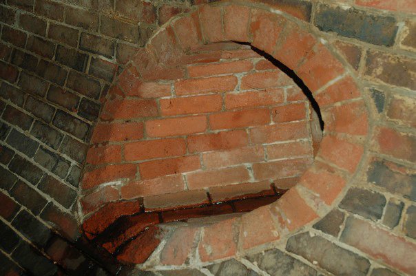
This stream, and apparently hundreds of others like it such as the Capesluit which runs off Devil’s Peak, now run under the city of Cape Town in a huge network of round storm-water tunnels and drains and effectively every day the city chugs along while enough high quality potable water to give every man, woman & child in greater Cape Town a litre of water a day, drains off the mountains, under the city and out to sea. Lost.
And in a time when the predictions are that many of our future wars will be fought over water, that seems almost criminal.
So about half-way through our under-city journey (which reminded me greatly of that very corny 80’s TV series with the tall cat-faced man in long coat with long hair living under New York city and saving people from themselves, called Beauty & the Beast – there being a suitably pretty city girl with big hair who falls in love with him to complete the picture) I realise that this is what happens when you let history go underground. You lose track of where you’ve come from, you lose sight of your origins and your inspiration and the very things your identity is built around. You lose touch with the sweet water that is your essence. And you stray, just like Cape Town has, until you’re at such risk of running out of water completely that maybe you’ll remember that once sweet water ran through these streets and do something about reclaiming it and actually having a future to look forward to.
The same thing happens to people.
And the same thing happens to brands.
It seems to me that companies, marketing execs, brand managers and powers that be are often far too keen to re-think, re-formulate and “progress” their brands, forgetting that often there is a pearl, an essence, a sweet water soul that gave rise to that brand somewhere in the far reaches of its’ history that has been lost in the underground of memory and file stores, and that is no longer informing the growth and sustainability of that brand.
Now don’t get me wrong, I’m not advocating casting brands in stone and never touching them again, but I do think that the pace at which we live, and breathe, and sell, and change, and communicate is sometimes leading us astray from the very core of our brands, and in doing so we are sacrificing the souls of our brands. And this is not a soft argument. Yes, continual re-invention is great for brands. But only if they are strong at their core. Like humans, if you let slip the core you get soft in the middle and around the edges, and it all goes south from there.
Keep your brands up to date, in touch with consumers, and growing with the times, but also keep them strong in the middle. Hold on to that magical essence that was the seed of the brand and usually is still what sets it apart from the competition, and build on it, not away from it. To paraphrase Einstein, stand on the shoulders of giants and you will see much further.
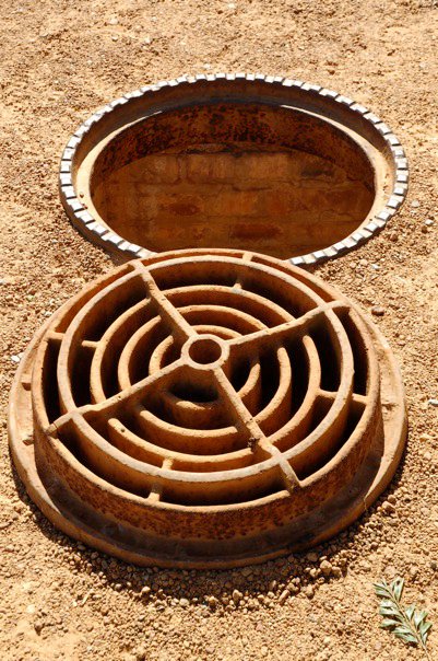
And if you should be feeling that you’ve lost that sweet water somewhere along the way, I recommend taking a walk in the underground tunnels of your brands for some inspiration. Despite the cockroaches, spiders, frogs and crabs, you might also find the water running softly over the worn red bricks under your wellingtons, and a glimpse of wonderful sky every now and then through a manhole cover. The magic is still there, sometimes you just have to change your perspective to find it again.
March 8th, 2010 at 12:52 pm
Lovely blog you have here.
An acknowledgment from whence you ‘lifted’ the pics is very important at a time when most respect and acknowledge ‘the commons’. RECLAIM CAMISSA has functioned unfunded for 5 years – your acknowledgment of source could have generated further support for our cause….’to reclaim the place of sweet waters’.
I also ask that you check your historical facts here…for e,g the Capelsluit & the Platteklip & this subterranean gracht – are all one and the same 🙂
May I utilise this opportunity to expose your readership to the fansite for RECLAIM CAMISSA: http://zh-cn.facebook.com/pages/Reclaim-Camissa/201229746552
Kind regards, Caron von Zeil
March 10th, 2010 at 10:19 pm
Hi Caron
Thanks very much for your comments on my recent blog re the underground CT walk, I hope you don’t feel that any of the things you point out were done maliciously – I assure you that was not the intent!
With regards the info – I very much attempted to verify all the information that was on the handout we were given on the walk, but could not do so on any of the facebook sites or anywhere else, so I used it as it was on that handout. If you could let me know exactly which facts were incorrect, I will happily correct them.
I also on the first draft had a reference & link to your website, but when I checked it it still said “coming soon”, and so I removed it again and simply left the facebook comment in so that people could search there if interested. I also do acknowledge the pictures as coming from your Facebook page in the “tags” section at the bottom of the page, so hope that suffices?
Thanks for the response and the informative walk, hope I have allayed your concerns re my blog.
kind regards,
Anneleigh.
ps. Attempted to send this to your email address, but got a “permanent failure” response!